
 AIS Resources – updates to Yalgogrin page
Yalgogrin Gold Project, West Wyalong, New South Wales, Australia
The Yalgogrin Gold Project includes two drill-ready Exploration Licences (ELs) – the 56 sq km EL6030 and the 2.8 sq km EL5891 tenement. The advanced gold projects are located in the historic West Wyalong gold corridor of central New South Wales, Australia. The West Wyalong gold corridor produced 445,700 ounces of gold mined between 1894-1921. The project includes seven historical mines, 31 drill holes, extensive auger and many outstanding shallow gold intercepts with up to 32.2 g/t Au. The vendor is a senior consulting geologist with experience working at the Victoria Fosterville gold mine.
Located in the Yalgogrin Gold Field
The Yalgogrin Project advanced-stage exploration project is in the Lachlan Fold Belt of NSW in the historic Yalgogrin goldfield, 37 km west of West Wyalong. This region has seen significant gold mining over the past 100 years and currently has three major operating gold projects:
- Cadia Newcrest 220 km north west producing 900,000 oz of gold a year
- Lake Cowal Gold Mine which is 40 km from Yalgogrin project, that was purchased by Evolution for $550 million
- North Parkes, a copper and gold mine 168 km to the northeast that in 25 years has produced 1.464 million ounces of gold and 1.168 million tonnes of copper
- Thomson Resources Ltd (ASX:TMZ) has staked around the EL5891 tenement completely
There is paved highway access only 37 km. west of the town of West Wyalong on the Newell Highway and 595 km. north of Melbourne.
Local Geology – Yalgogrin Gold Project
The local geological environment is a magnetic, magmatic complex of Ordovician age located within the Lachlan Fold Belt. Numerous gold deposits occur in the West Wyalong Temora Adelong district, many of them close to the Gilmore Suture, which is delineated by regional aeromagnetic and gravity data. A sequence of late Ordovician metasediments, which have been intruded by granites of mostly Silurian age is situated to the west of the suture. To the east of the suture, Ordovician metasediment strata form a basement to an extensive sequence of volcanics and sediments, which have been intruded by granitic dioritic, and gabbroic bodies of mostly Early Devonian age. Granodiorite phases of the Siluro-Devonian batholiths are the host to, or were the source of substantial primary and secondary gold mineralisation at Adelong, West Wyalong, and Sebastopol-Junee Reefs (some ore bodies) along the Gilmore Fault Zone.
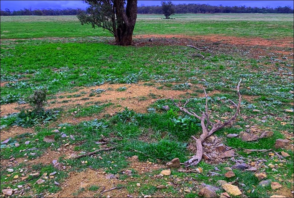
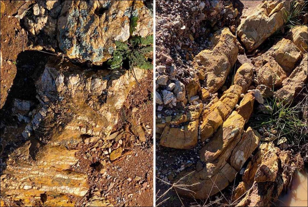
From left to right looking from Holland to Walsh’s along the depression (mineralised area) with a rehabilitated historic mine in the foreground near True Blue and Adelaide historic workings.
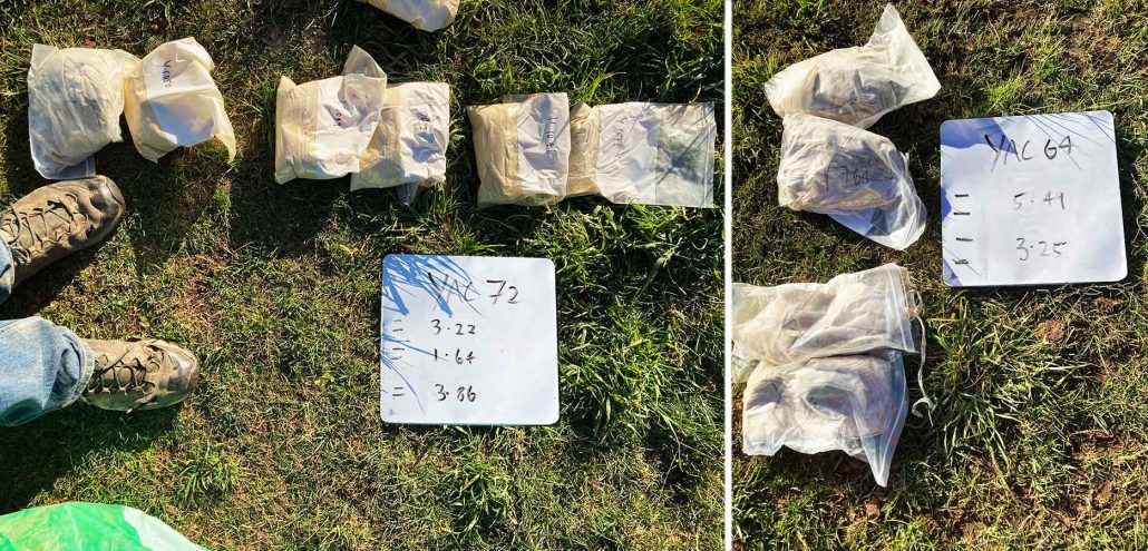
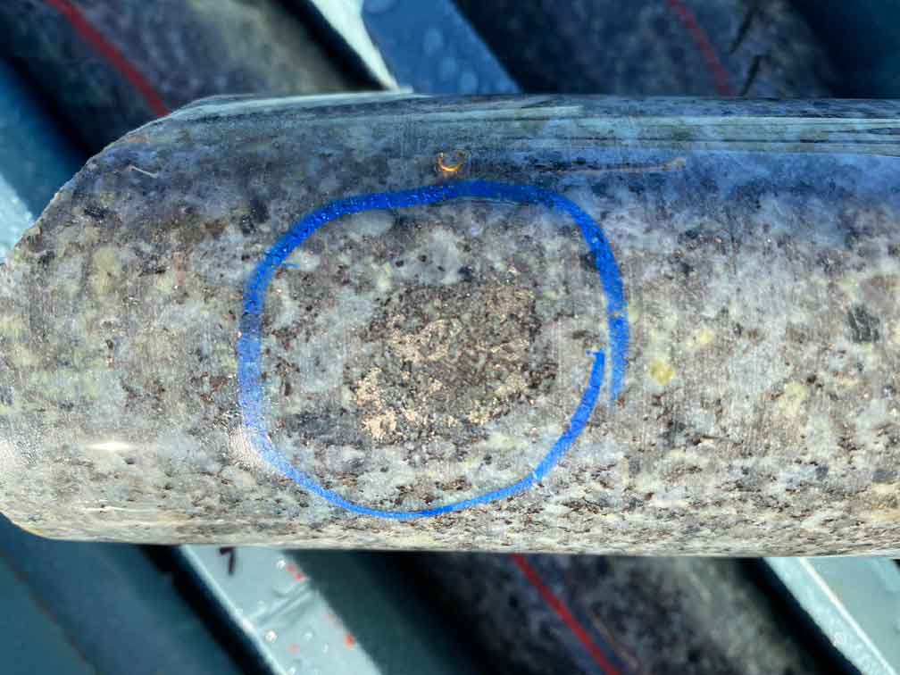
(L) Sample bags from hole YAC72 and (R) YAC64 showing the sample that assayed 5.41 gm/t Gold
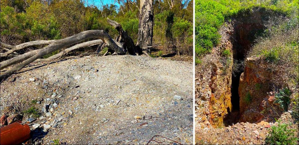
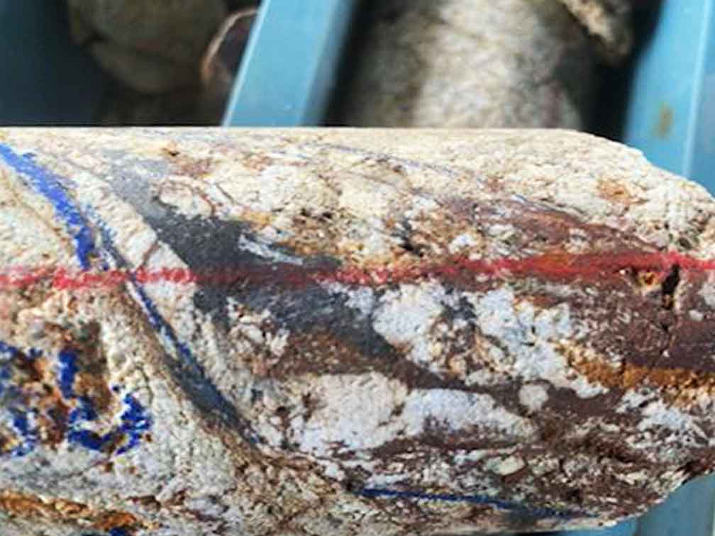
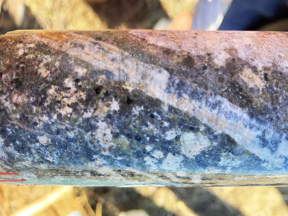
(L) Talmore mine showing carbonaceous slate and (R) Asia Wyalong mine and shaft with visible drives and a depth of 91 metres.
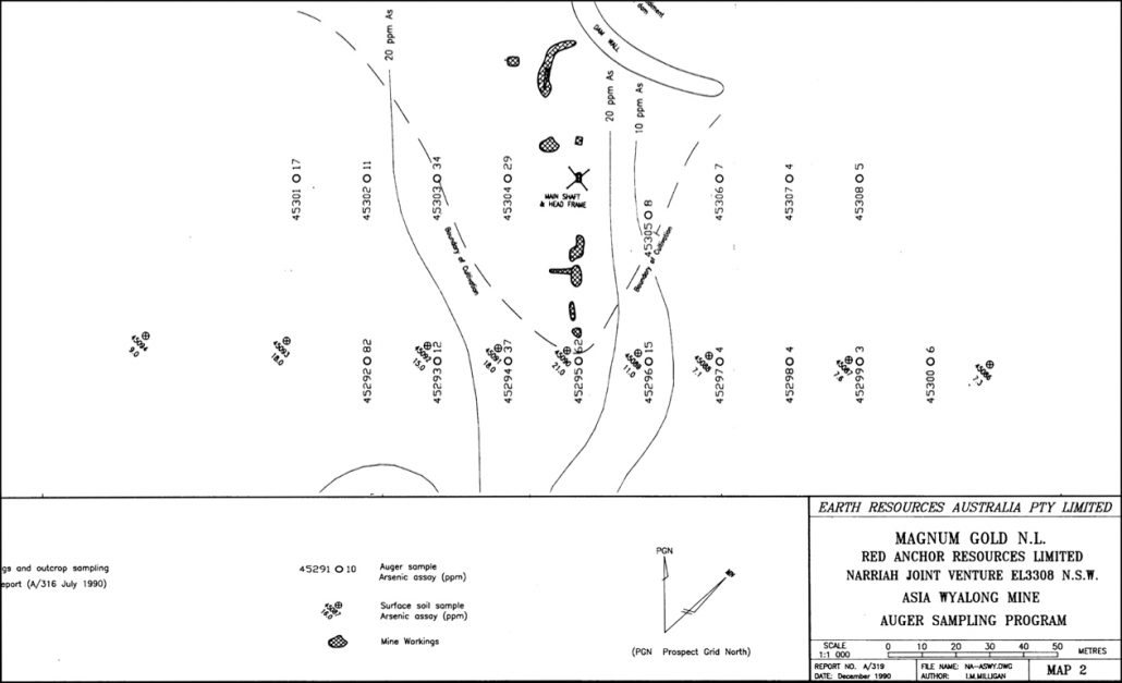
Arsenic is correlated with gold and this map shows the Arsenic (As) contours and old workings, and sampling along the creek.
(L) Quartz veins intruding cracks in host rock at Asia Wyalong mine and (R) Folding in bedrock with tensional cracks and quartz veins at Asia Wyalong mine.
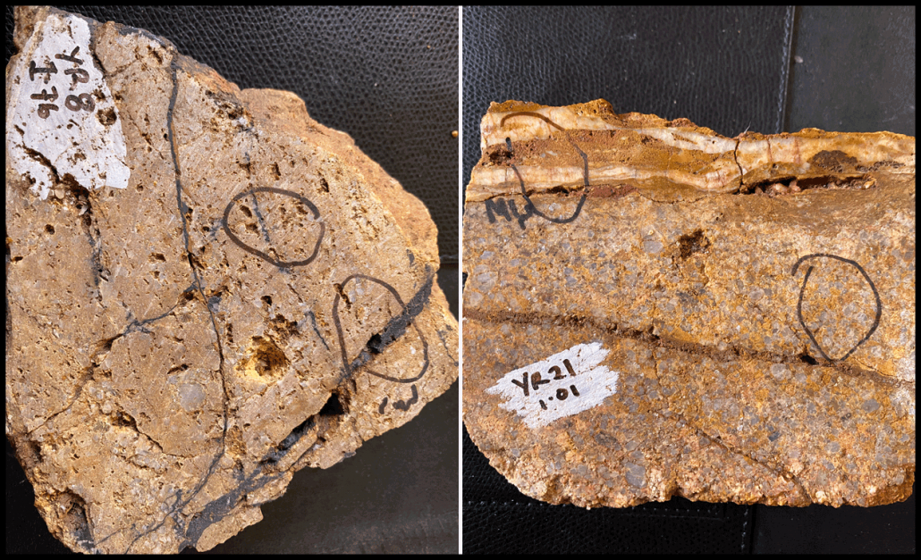
(L) Sample fire assay 1.76gm/t Au with manganese replacement and pyrite crystal voids and (R) Sample fire assay 1.01gm/tonne Au and a large pyrite crystal void.
Drill Ready YalgogrinGold Project
The Project is geophysics and drill-ready with 3,795 metres over 14 drill holes already completed and a substantial drill hole and magnetic survey database from other explorers from 1953 when BHP explored the area. Recent auger results were 12.5 gm/t and 32.3 gm/t, and 14 DDHs with intercepts ranging from 1.9 gm/t to 1m at 21.5 gm/t.
The Yalgogrin tenement offers:
- Mineralised system of significant scale containing numerous ‘walk-up’ drill targets
- Open high grade near surface intersections
- Untested historic workings with reported high grades
- Bulk tonnage lower grade potential
- Oxide heap leach plannedLand access secured and excellent relationships established
- Land access secured and excellent relationships established
Six Reefs Discovered On EL6030
Approximately 10.1 km southwest of Yalgogrin is a group of workings comprising the Asia-Wyalong Mine, Rowe and Prestons Mine, and the Sheehan Mine, which were staked as EL6030. Further research has identified six reefs in the Asia Wyalong – Sheehans historic mine area. Magnum Gold NL conducted some auger drilling in 1990. The main workings comprise of three shafts up to 91.5 m deep, drives, crosscuts, winzes, stoping and shallow pits extending about 15.3 m over the surface. Prior work was mostly carried out between 1932 and 1936 on a number of quartz veins, which were between 0.76 and 2.2m wide. They strike 340 degrees, with a near vertical dip.
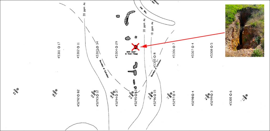
Altogether there are six parallel reef lines within a 60m wide strip. They run parallel to the cleavage and include numerous smaller crosscutting veins. The richest gold is reported to have come from the intersection between the main veins and the smaller veins. Officially, a total of 21.225 kg of gold was won from ore yielding 36g/t (1.15 troy oz) Au up to 1936. Map #5 below shows the arsenic contours that correlate with gold at 20 ppm, eight mine workings, the main shaft and head frame and the auger locations.
Exploration Strategy – Yalgolgrin Gold Project
The primary exploration targets on EL 5891 are large tonnage low to medium grade deposits amenable to open pit mining. The secondary exploration targets on EL 5891 are high-grade resources amenable to underground mining. The tenement is deemed prospective for high-grade mineralisation due to:
- Extensive gold in soil anomalism
- Historical high grade gold mining
- High grade rock chips
- Extensive low grade rock chips
- Extensive mineralisation identified in trench sampling
- Intersecting mineralized veins sets
- Extensive mineralisation intercepted in drilling
- Extensions to known mineralisation interpreted from high resolution geophysics
- Location in a historic gold field within a regional setting that has large tonnage deposits that have been mined
- Distribution of historical workings
- Large resources that have been identified in similar settings globally
Exploration Interpretation – Yalgolgrin Gold Project
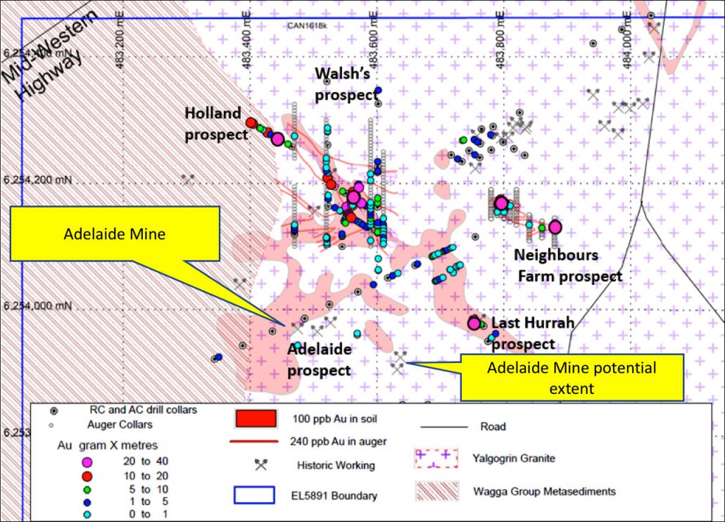
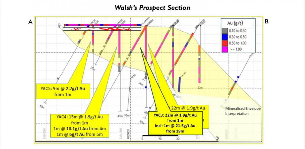
Interpretation of a 250,000 to 350,000 m3 target extending from the Hollande prospect through to Walsh’s prospect has been ascertained from 21 drill holes (including AC and RC) and three costeans. The body is dipping at approximately 30 degrees to the southwest and interpreted down to 35 m, which approximates base of oxidation evidenced by aircore refusal. The average intercept grade ranges from 0.5 to 2.5 g/t Au within the target. Waste to ore ratio of the interpreted body based on simple pit outline approximates 2:1. The mineralisation is open along strike to both the northwest of Hollande and also to the southeast of Walsh’s as shown in photo #2 above. Rehabilitation work has been completed and the report lodged satisfactorily for the 69 auger holes and 27 RC and air core holes.
Exploration Plan – Yalgolgrin Gold Project
The goal is to fast-track the Project towards resource estimation, feasibility and then mine development in the Neighbour, Last Hurrah, Walsh, Adelaide, and Holland deposits. The Adelaide mine area is not been drilled yet. The plan includes:
- IP geophysics and drilling as soon as possible with a focus onBulk Tonnage, near surface lower grade opportunities
- Down dip/plunge and along strike of Holland/Walsh’s/Last Hurrah 500 m trend, Bonanza grade narrow vein targets near Adelaide Mine and down dip/plunge of 140 m strike workings to 55 m depth, grades equivalent to 1 m@24 g/t Au
- Bonanza grade narrow vein targets at Neighbours Farm
- Down dip/plunge of 14 m @ 2.6 g/t Au (entered old stope) from 1 m and along strike to 32.3 g/t Auger result
Our objective is to define the oxide resource, provide targeting guidance for deeper exploration. In summary the program includes:
- 5000 metres percussion reverse circulation with downhole geophysics (Optical televiewer)
- 240 metres of oriented diamond core holes (HQ3)
- QA/QC, DGPS survey, downhole surveys, handheld pXRF multi-element
- Gold fire assays with 50g charge on 1m intervals
- Preliminary metallurgical test work, resource estimate of oxide mineralisation
- An IP survey to guide further exploration at depth.
Drill holes and trenching on EL5891 with historical mines.
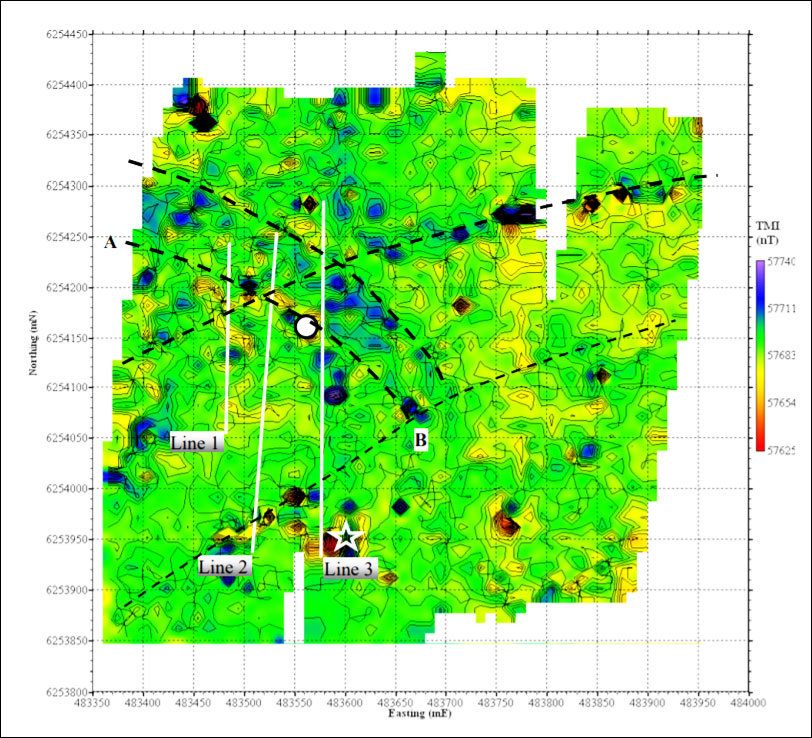
Total magnetic intensity map. White circle represents centre of pit. White star indicates location of metallic debris. White lines indicate locations of the three TEM coincident loop profiles. Line AB reflects trend in TEM data. Black dashed lines indicate major fracture systems and possible drill targets.
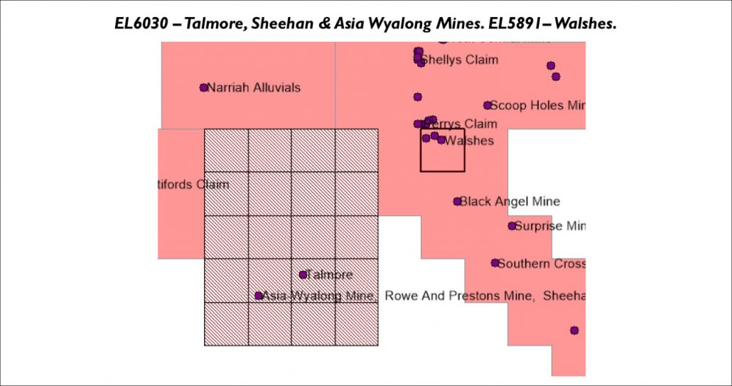
EL6030 covers 56 sq. km. including the Talmore, Sheehan and Asia Wyalong mines, and EL5891 covers the Walshes.
Geological Model from Drill hole data on the tenement.
Arsenic is correlated with gold and this map shows the Arsenic (As) contours and old workings.
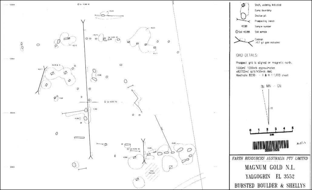
helly’s mine workings and exploration showing gold in 9 occurrences >0.2gm/t
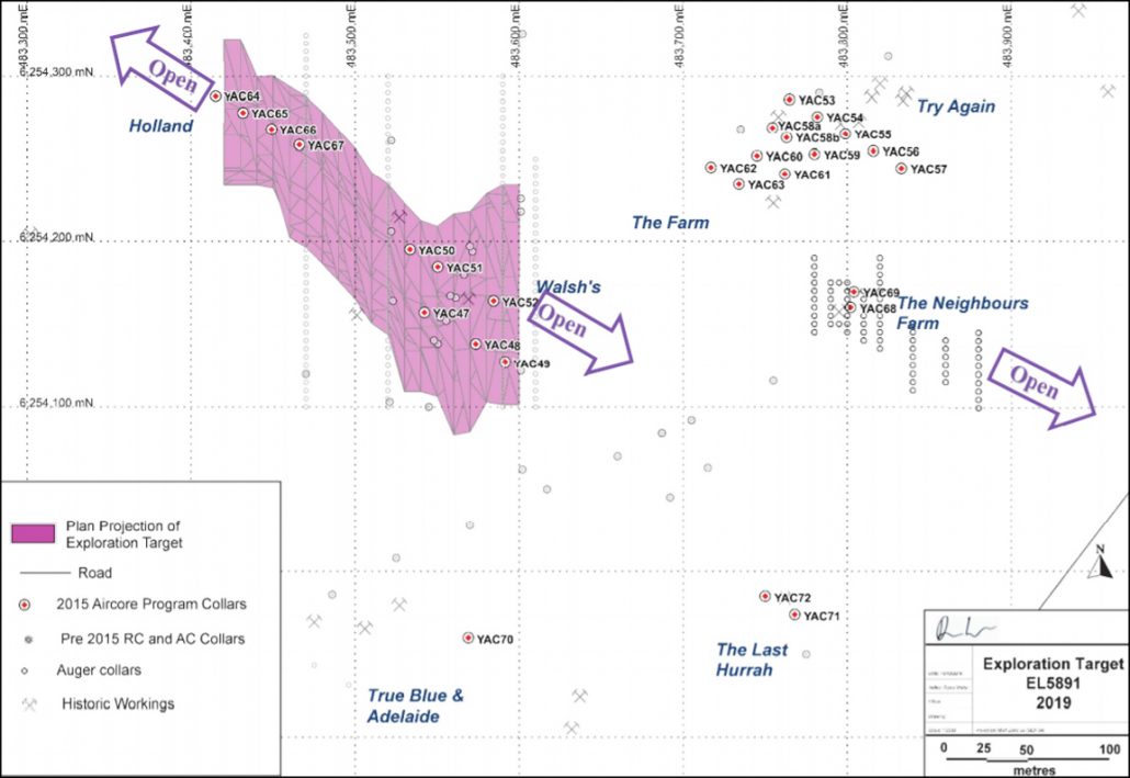
Location of Walsh’s – Hollande exploration target Yalgogrin EL 5891
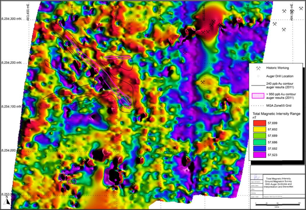
Magnetic survey showing Au soil contours and magnetic values in nano teslas with pink lines delineating areas of interest with >950ppb of gold.
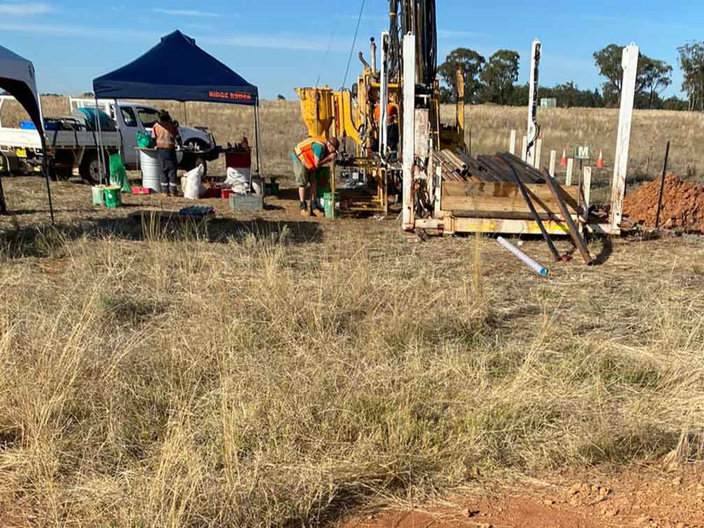
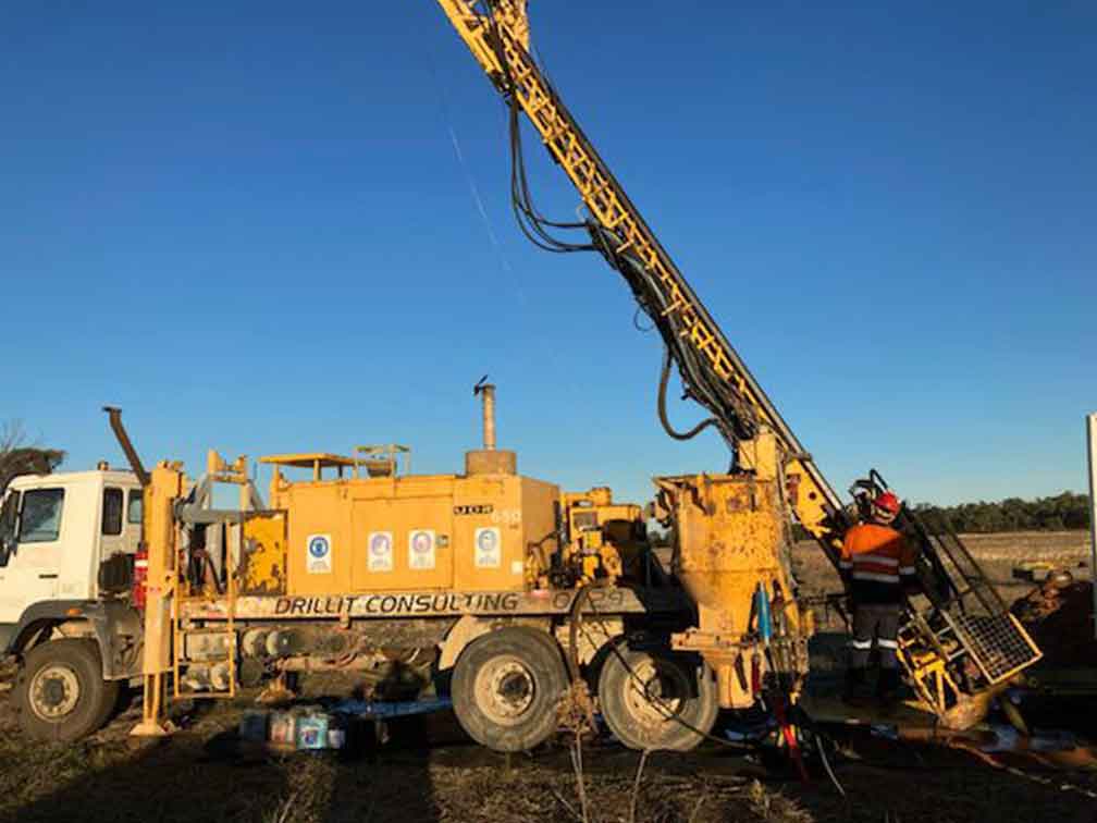
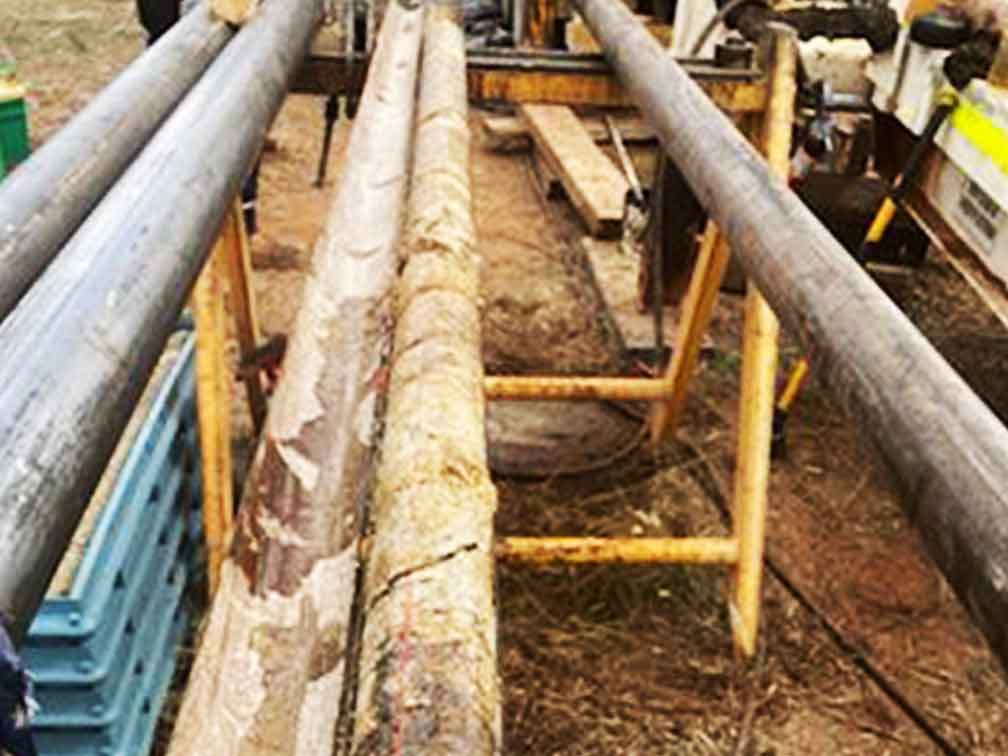
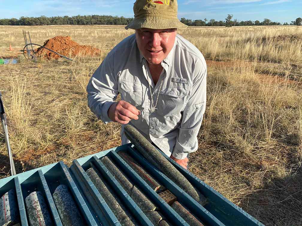
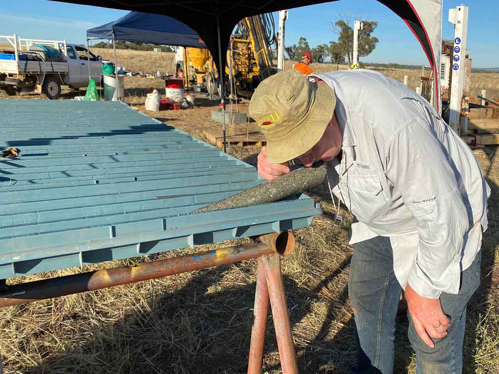
AIS Commences Drill Program at Yalgogrin Gold Project
In early March 2021, Drillit Consulting from Parkes NSW mobilized their diamond drill rig and commenced drilling a 1,000 m drill program on its highly prospective gold bearing Neighbours Farm Prospect, part of the 60% owned Yalgogrin Property on the Lachlan Fold Belt, NSW, Australia.
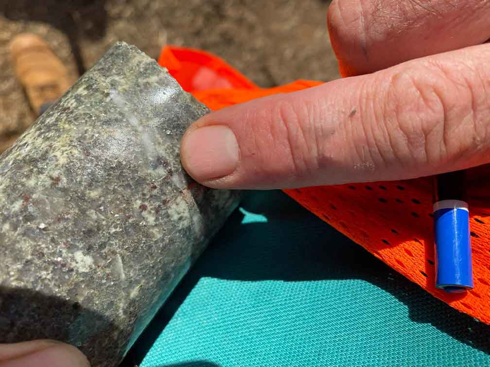
Phil Thomas, CEO commented “We have been able to combine the geophysics with new 3D inversions to better target the drill holes where 32.2g/t Au have been recorded at 0.5m below surface at the Neighbours Farm Prospect. These geophysics results suggest a high probability of exceptional grades in the oxidized zone down to roughly 30m depth. Deeper drilling will also be carried out in the granites below to target the sulphide zone.”

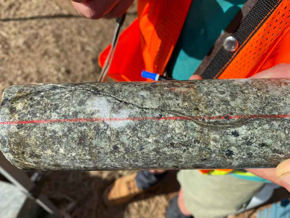
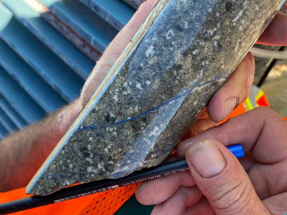
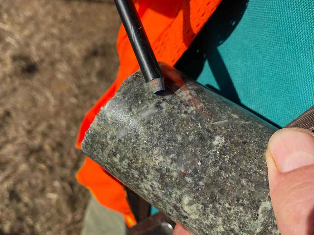
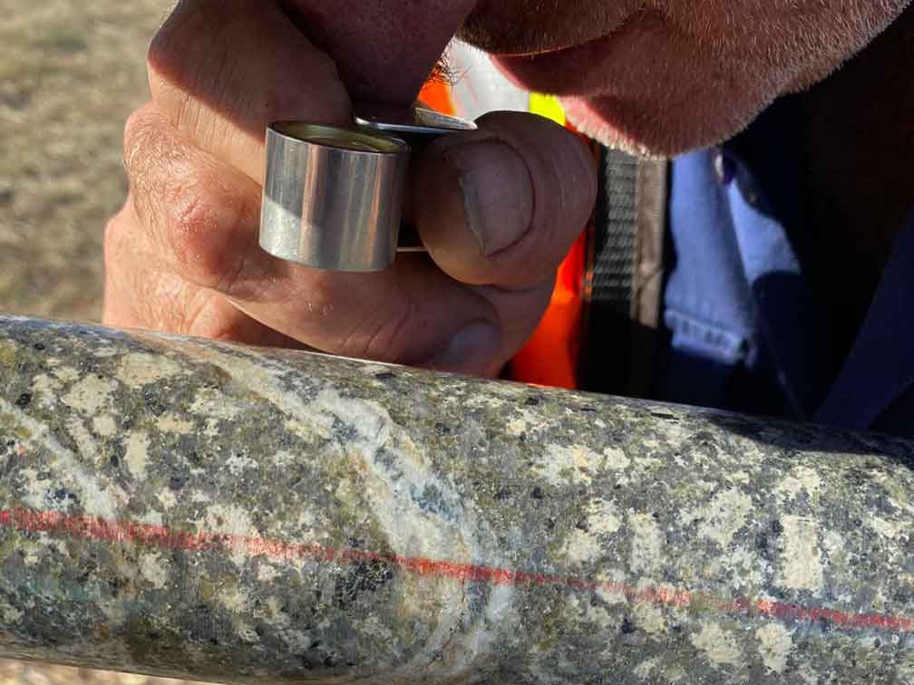
AIS-Resources-Yalgogrin-Project-Drilling-01

AIS-Resources-Yalgogrin-Project-Drilling-02
AIS-Resources-Yalgogrin-Project-Drilling-03
AIS-Resources-Yalgogrin-Project-Drilling-04

AIS-Resources-Yalgogrin-Project-Drilling-05

AIS-Resources-Yalgogrin-Project-Drilling-06
AIS-Resources-Yalgogrin-Project-Drilling-07
AIS-Resources-Yalgogrin-Project-Drilling-08
Related Posts
Tags
Share This


